Operating instructions, user manuals for products from manufacturers of any brands. "SHTURMANN Team" - a new tariff plan from MTS for users of SHTURMANN Link300 GPS navigators ⇡ Outside and inside
The Navigator Shturman Link 500 combines all the necessary and most popular functions of a car device. Compared to many navigation devices, it looks more than worthy, because it is quite inexpensive. Default services such as Yandex. Traffic jams allow the driver to enjoy the driving process and receive timely information about the condition of the roadway.
Main characteristics
Shturmann Link 500 is equipped with a 5-inch screen with a fairly wide resolution of 800*480. There is an integrated GPRS module that provides an Internet connection.
Among the main advantages of this device are the following:
- high color rendering;
- widescreen extension;
- integrated module providing connection;
- constant updating of data on the state of the roadway using data downloaded to the device
- programs;
- specially developed and unique navigation program Navigator;
- SIM card mobile operator MTS with the “Team Navigator” tariff.
The main advantage of the device is the ability to use the “Navigator command” function. The convenience lies in the fact that by teaming up with friends and relatives, the car owner will always see their location on the city map.
Important! Thanks to the integrated module, the navigator can be connected to world wide web without communication with other mobile gadgets, that is, it works completely autonomously.
The Navigator Shturman 500 has modest, by today's standards, characteristics, but this does not prevent it from satisfying the needs of average users. The main characteristics are shown in the table.

| Characteristic | Designation |
| Type | Automotive (portable device) |
| Map | integrated |
| Ability to download additional maps | + |
| GPRS module | Built-in |
| Possibility of route calculation | + |
| Display type | LSD |
| Screen size | 5 inches |
| Touch (multi-touch) | + |
| backlight | + |
| CPU | 500MHz |
| Voice alerts | + |
| Built-in memory | 2 GB |
| RAM | 128 MB |
| OS | Windows |
| antenna | built-in |
| Hands-free mode | + |
| Battery capacity | 1500 mAh |
| Application of additional external power supplies | + |
| Headphone jack | + |
Users of Shturman navigators have the opportunity to receive information about traffic jams on city roads in real time. In addition, after installing the programs, the user gets the opportunity to see information about the poor condition of the roadway:
- closing a certain lane;
- repair work.
This moment makes the life of a motorist much easier, because in conditions of congested roads in large cities, such information is very valuable.
Important! The functions operate not only in large cities, but also in small provinces throughout Russia.
By purchasing a device, the user gains the opportunity to use its additional functions:
- viewing a photo;
- watching videos;
- FM radio;
- MP3 player.
The undoubted advantage of the device is its dimensions - 136 * 85 * 14 mm. Small sizes allow you to place the device on the front window of the car without obstructing visibility.
Device contents

The price of the device is less than 5,000 rubles, but for this price the user purchases a fully equipped device. Opening the box, you can be truly surprised, because many manufacturers save on this, but Shturman is rather an exception to the rule.
The user purchases the following components:
- the device itself – navigator navigator Link 500 500;
- car mount;
- Charger for use in the car;
- case;
- cable for connecting the device to a computer;
- operating instructions for the device;
- warranty card from the store and manufacturer;
- MTS SIM card for connecting to the “My Navigator Team” service.
The device itself is made of durable plastic. There are no special decorative elements. There is a film on the device screen. All connectors for connections are located on the right side.
Important! The device's predecessors had sockets on the left side, but the manufacturer identified an error. When connected to the right, the wire hangs in an intrusive arc and prevents the driver from following the road.
On the lower side of the device there is a slot for placing a SIM card. Installing a mobile operator card completely solves the user’s problem in connecting to the Internet, through which up-to-date information about the status of the communication path is displayed.
Important! The gift tariff from MTS “Team Navigator” is no less valuable than the navigator itself. The user has a chance to pay only 99 kopecks per 1 MB of information received.
The design of the mount itself, which ensures the stability of the device in the car, looks quite powerful. It is made of durable plastic, with metal elements in places. The mount is equipped with a special ball joint, thanks to which the device can be freely rotated in three accessible planes. Just one touch of the screen allows the user to set the optimal viewing angle.
Fact! The car enthusiast will have to get used to getting into the latches to install the device on the fixing platform.
After turning on the device, the user gets acquainted with the menu. It looks quite simple, so a motorist can intuitively guess what exactly is located behind the icon. The sensor is quite sensitive; drivers do not complain about this element.
Taking reference from such industry masters as Garmin, TomTom or Mio, who offer original software with a closed OS on their devices, the creators of SHTURMANN did not forget that they were moving across the expanses of the Russian market - and left the system open!...
This time we will break the established order of review and start not with a description of the case and fasteners, but immediately with the functionality. And there is a reason for this. Take a look at the following photos:


Here we see the loading screensaver of the original SHTURMANN navigation software, and then we see how programs from other manufacturers are launched on the same device!…
Many have probably already appreciated the essence of what is happening, but just in case, I will explain in more detail.
On this moment The entire car navigator market can be quite clearly divided into two groups. One consists of devices with original navigation software and a closed operating system that does not allow installation and use third party programs. This is the path taken by such masters of navigator engineering as Garmin, TomTom and Mio. On the other hand, devices that do not have their own original programs and are initially aimed at using various third-party software, and accordingly, allow the user to install different navigation programs at will. In this group there is a whole scattering of so-called. ODM products, manufactured in China, branded and promoted to the market - such as Texet, Lexand, GlobusGPS, PocketNavigator, etc.
And here in the case of SHTURMANN we see a kind of “third” way. On the one hand, “Navigator” came from the same ODM source and retained all the features of its universal “brothers”, but on the other hand, this device offers its own software of the same name, which unites it with the group of “originals”.
And for the Russian market this path is very correct, this path is ours. One can, of course, argue that “Navigator,” which itself initially offered only devices equipped with third-party software, has now, having released its navigation program, simply “automatically” inherited its “versatility.” And everything we see here: “original software + open OS” - all this happened “by itself”.
But then the question is - what prevented the developers from completely closing the system (especially since technically this is a couple of trifles), without launching any third-party software, as is done, for example, in Mio navigators, which are based on the same WinCE, only locked from all others programs.
But the creators of “Navigator” were not greedy and left the system open. This is a huge plus for our market: if desired, any user can put their “great Aygo” here and ride around, rejoicing. True, in any case, when driving around Russia, “Aygo” is not really needed here - the native STURMANN software “drives” very, very well. However, more about him later.
Now take a look at the next photo - here’s another “trick”!

Until today, I have not seen the ability to minimize the navigation application “to the floor” and use other functions of the device on any car navigator running WinCE. Everywhere, for example, to make a phone call or even just adjust the sound or brightness of the device, the navigation program has to be closed and then loaded again. Here we already see functionality from devices of a different class (and price!) - GPS communicators. At the same time, the “minimized” navigation also runs in the background - the device continues to “speak” directions for turns, and when the map returns to the screen, it shows a new, current location.
We can talk endlessly about the practical convenience of such functionality. When the sun comes out and hides behind a cloud, when you turn off the music to talk on the phone and then turn it on again - you constantly need to adjust the volume and brightness. On conventional car navigators under WinCE, this requires either closing and reloading the “navigation” again (which takes time), or (which usually happens) to endure and wait for the external conditions and circumstances to return to those for which the settings were made.
But here you don’t need to: minimize the software and “twist” the device as you want. Moreover, the main used settings “volume” and “brightness” are adjusted directly in the navigation program. However, as I already said, more about it later.

Since I’ve already started, I’ll probably continue the topic of menus and functionality.
All main menu items are located on one screen, which is both technically sound and convenient to use - you don’t have to “twist” or “scroll” anywhere to select the desired section. Large white “key” icons on a black background are visible very well, although, in my opinion, it would be even better if they were made in different colors - then the perception of the menu would be generally “six plus”. Although, perhaps, the developers were afraid of excessive diversity and decided to make the design “calmer.”


The second level of the menu is identical in structure and design to the first, which, in my opinion, is also very smart and convenient to use and perceive.
The speed of moving through the menu is quite fast; there were no obvious “brakes” or “falling asleep” when moving from point to point and from level to level. The only thing is that sometimes the device began to respond with a delay to clicking on the “arrow” (back), when you entered the lower level and immediately wanted to go back - then the response occurred in a couple of seconds. (Apparently, the screen worked, but the device itself has not loaded the level yet.). If you don’t try to go back right away, the “arrow” responds without delay.
The quality of the screen is quite standard for devices of this class - the brightness was enough for me in all cases; in the bright sun, the display, of course, faded somewhat, but the map still remained legible. There were also no problems with viewing angles, especially since the navigator is always set to an face.
Regarding the set additional functions and their implementations, they are also typical for navigators of this class. The only thing is that there are no games in the navigator, which I personally applaud. Bravo! And this is not irony at all.
In general, it has always been unclear to me why such completely unplayable games are installed on car navigators, especially some wild Tetris or Arkanoid games, or, even worse, Chinese Go checkers, the rules of which no one in our country knows. Among all my friends who use car navigators, no one plays games on them. Of course, I’m not Gallup or VTsIOM, but something tells me that there are only one or two such “players”. If branders receive these games from ODM suppliers for free along with the platform, then it’s understandable that they don’t look the gifted bonus in the mouth, but if they pay for them separately, forcing, in turn, the buyers of the devices to pay, then I don’t understand this.
It’s only a pity that the developers didn’t add PDF, Word/Excel and other MS Office viewers here, since the device has a browser and mail client. But here you can probably come up with a trick: write the necessary viewers for WinCE to the memory card, and then launch the “executives” through the “navigation path”. Of course, you'll have to tinker with it every time, but as a possible alternative, it'll probably work.

By the way, about the browser. This is already known around and everywhere Explorer for WinCE, similar in implementation to standard browsers V mobile phones. The navigator has its own GSM/GPRS module (accordingly, a SIM card is also installed), but without support for the EDGE standard.
To download information about traffic jams, GPRS speed is more than enough - all data is updated quickly and without slowdowns. But for Internet “surfing” this speed is clearly not enough, and the pages are loaded as if through an old “Daylap” modem through a telephone line. So “walking through the vastness of the Internet”, opening page after page here will be problematic.
But on the other hand, if you have, say, a couple of favorite sites that you are used to checking periodically, the browser can serve you well, allowing you to pass the time pleasantly.
And a few more words about the GSM/GPRS module itself, or rather about the SIM card. Now the navigator is sold with an exclusive tariff from MTS “Team Shturman” with a very tasty price for traffic - 2.98 per 1 MB throughout Russia (except for the Penza region and the Chechen Republic), and without a “subscription”. Unfortunately, I was not able to find out for sure whether there are restrictions on the data transfer speed. If it’s not there, then it’s just an excellent roaming SIM card for the “USB modem + laptop” combination.


There are no questions or complaints about the operation and interface of the navigator in “phone” mode. Everything is clear, simple, visual.

At the end of the conversation about the electronic filling, look at the funny “feature” of the device.
After installing third-party software from a memory card, a white bar appears on the bottom of the screen - at first I thought it was a screen “glitch”. But somehow I accidentally clicked on it twice with the stylus and a standard WinCE panel emerged from under the proprietary shell of the device. At the same time, the device does not have a separate entry point into WinCE, bypassing the shell. After removing the card and rebooting the device, everything disappeared without a trace.
As the technical support service explained to me, this “feature” is a feature of the firmware, which has been eliminated in the new version (available free of charge to all users).
Although I didn’t change the firmware - this thing doesn’t bother me. It also does not affect the operation of the device in any way - no “brakes”, no “freezing”, neither in the menu, nor in navigation.
Well, and now about the appearance.

The design of the case is simple and functional. I don’t know whether it was intentional or not, but here they did not put emphasis on aesthetic “highlights” and delights, believing (perhaps quite rightly) that the most important thing for navigators is what’s inside.
The assembly and quality of the plastic case are at a high level - I didn’t notice any creaks or crunches (which, by the way, happens all the time) even when I pressed quite hard on the corners. The glossy plastic gives the impression of being durable.
At the same time, due to the successful choice of dark gray color, fingerprints are practically invisible on the gloss. By the way, “staining” is a common problem with black glossy devices, which need to be wiped with a rag after holding them for two minutes. Here the device retains a clean and tidy appearance for a long time.


On the left side of the case there is a miniUSB connector for connecting a car charger and connecting to a PC, and a standard headphone jack. Here I would like to note, by the way, that the connection to the PC goes without problems and installation of additional software, but for some reason my computer refused to see the card I installed in the device, but only its own memory.
On the right side we find slots for the SIM card and card microSD memory, covered with rubber plugs, and next to them, on the top side, there is a button to turn the device on/off. And again I’ll note here - the plugs are very tight, opening them was sheer torture for me. Although, perhaps this is because my navigator is new and it will be easier to change maps over time.
And one more thing - there is no slot for a stylus in the case, but it is included in the kit. Basically, the menu of both the navigator itself and the program is oriented for finger control, and a stylus is not needed here. But for different fine adjustments“At some points you may need it, so you should try not to lose it. An alternative is to buy several cheap ones somewhere on the market at once, scatter them around the house and car - you’ll always find one.

The mounting bracket is made of an unusual material - not the usual black, but translucent plastic. Were you original to attract attention? But for me personally, the main thing is different - the holder is comfortable and works well. The design with a ball joint and a clamping nut allows you to set the desired angle of inclination of the device down to a millimeter.
![]()
The kit included two cases - one made of high-quality “bag” leatherette, and the second velvet, which can be used to wipe the device.
Details specifications looking at devices

...And to be continued - the second part of our review is now being prepared, where we will talk in detail about the original navigation software of the SHTURMANN brand.
High-quality navigation systems are not found too often these days. A new version Shturmann Link 300 is capable of not only perfectly showing the driver the way, but also delighting with additional interactive service capabilities. The navigator really shows its own skills without any problems.
The device provides secure access to the Internet, allows you to send and receive SMS messages, and also supports popular social media. All these features have helped him move forward in the rankings of the best and surpass some famous manufacturers.
Instructions for installing the program
With the Shturmann Link 300 device, the instructions will be an excellent assistant. Actions must be performed exclusively in this sequence:
- First, turn off the device and remove the memory card.
- Then open the card reader program and look at the contents.
- We copy all the data present on the card to another storage source and format it.
- The downloaded archive contains the contents of one directory (Copy content to SD card). It needs to be copied onto the card.
- Now you can insert the map into the device and launch the navigation system itself.
- A window immediately appears, click the “Registration” button. Then programs appear on the screen, and with them a text input field in which you enter registration key(available upon registration of the program).
- Click the "Next" button and wait for the files to download.
- In order for the action to be carried out automatically, you need to go to “Menu - Settings Panel - GPS - Settings”. Next, click the “Connect” button. Installation completed.

Like this in a simple way you can launch a navigation program that will serve the owner for a long time and reliably.
Design
In appearance, the Shturmann Link 300 GPS navigator is quite simple. The body has a rectangular shape and is painted gray. It features smooth corners and a black display frame for added durability. The device itself is made of plastic, resembling a varnished material in appearance. All connectors are protected from dust by rubber plugs.
The weight of the device is only 280 grams, dimensions are 125 x 80 x 19 millimeters, and the diagonal is 4.3 inches. The viewing angle is sufficient for similar devices, and the horizontal view especially stands out. The image on the screen is clearly visible even on a sunny day. This navigator can easily be placed in your pocket.
Software
Operating system of this device is Windows CE 5.0. When purchasing anywhere, the user will be offered three options: “Avtosputnik”, “Citiguide” or “Navitel”. You can choose absolutely any one, since they all work perfectly.
A huge plus is that the menu icons are large. This makes it easy to hit the desired button, because in a car this function is quite important.

The navigator called Shturmann Link 300 does not connect to the computer mainly due to the firmware. To do this you just need to update old version, and then there will be no problems.
In addition to navigation features, the following additions should be noted:
- Ability to play audio files.
- There is a gallery for storing and viewing photos.
- Reading e-books provided.
- Calls and SMS notifications can both be received and sent from the device.
Equipment
Included with each Shturmann Link 300 navigator is a stylus for more convenient use, a disk with the necessary software, short but clear instructions for novice users. In addition to this, there are a pair of cases, a SIM card, a memory card, a cable for connecting to personal computer, mount and charger specifically for the car.
Screen
The Shturmann Link 300 GPS device has a gorgeous TFT display with a wide format resolution and an excellent diagonal of 4.3 inches. The screen itself is matte, which looks quite nice.

Work offline
Shturmann Link 300 has lithium ion battery capacity 1500 mAh. One charge allows the device to work for 4 hours. It should be noted that this is a navigator specifically for a car, and you can charge it there at any time. Therefore, a relatively small capacity will not be a problem.
Fastening
Especially for the car, the kit includes a special mount consisting of a car holder and a bracket with a vacuum suction cup. The Shturmann Link 300 holder is made of unique plastic, which is also translucent, which provides improved appearance device. It looks really beautiful and impressive. The white color does not show itself when attached to the side glass, unlike black.

Performance
The Atlas III platform has a 372 MHz processor and 128 MB of built-in memory. Shturmann Link 300 is on par with similar models, because its processor is a little weak. Navigating through the menu is carried out without any problems, but when scaling the city map, some slowdowns and the like may occur. Drawing the full volume of the map takes approximately 2-3 seconds. When moving around the map, sometimes exactly the same slowdowns are noticeable.
Navigation program
Core operating system, on which the device is based, plays a special role, since people most often pay attention to it when purchasing. Of course, the main part of the entire system is nothing more than the navigation program. When purchasing, a person has the right to independently choose from the three proposed systems, having found out all the facts about them that interest him. You can change the navigation version at any time, because all this is easily and simply done by the user manually.
The design of each program is unique; they were developed in the Lebedev Studio. The device contains detailed maps of many cities of the Russian Federation (Moscow and the region, St. Petersburg, and so on). The map of each city and region underwent separate testing; no errors or omissions were noticed.

The appearance suits the users. This is one of the few cases when everything is done in moderation and with taste. The application allows you to independently configure the type of route you need, select the screen brightness level and volume, and also determine the desired display points on the map and their appearance.
Navigation programs have some problems, for example, the functions are not yet quite sufficient for extensive use. There are no scaling settings and linking to some routes.
Searching for specific objects can be easily done using a convenient menu. The map itself can be displayed on the screen in both day and night modes. This option is switched in the settings, and the action is carried out automatically according to the set time. There are two types of display here: three- and two-dimensional.
A human navigator does not require spending an hour studying instructions. A functional navigator does not force you to take your attention from the road. A caring navigator makes sure that all the necessary data and settings are easily accessible. The interactive navigator shows traffic jams in the city, the location of friends, allows you to share with them valuable road information and the location of cafes with hot French rolls. The navigation program "Navigator" now has all these qualities.
In the car
The main menu shows the most important groups of functions: navigation (searching for a point, working with a route, setting) and auxiliary (communicating with friends, listening to music, viewing photos, etc.). There is always a reminder of the current route on the main screen.

The folded corner of the page reveals a map of the area hidden under the main menu.
Map
The map is the basis of the navigation program. The map shows the current position, information about the direction of travel, a route legend, information about the next turn and the remaining distance for it, time and distance until arrival at the final destination, speed limits on the current section of the route (optional).

Daytime view of a three-dimensional map
All maneuver indicators are accompanied by clear voice instructions. When driving at high speeds, the driver will be notified of the maneuver at a sufficient distance.

The next turn and the one after it are shown
The approach to the next turn is shown by a visual progress bar. For fans of exact sciences, the distance and time to the turn are displayed. If the driver is driving along a difficult junction, he has the opportunity to temporarily go to the information window about the nearest turn. As soon as a difficult section is completed (or when enough time has passed), the navigator will return to map mode.

Night view of flat map
IN top menu a clock is provided (there are no navigators on the market yet that would show the current time). The clock dial shows both the current time and the remaining time until arrival: during the last hour of travel, the orange rim decreases as you approach the end of the route. The calculated time and distance to your destination are shown below the watch face.
Statistics
“Navigator” remembers all the information about the route: distance, time and speed, number of stops.

Progress towards the final destination is shown schematically
Scale
It is convenient to view the desired area in all details, taking advantage of the zoom using the grid we have invented. In this mode, a grid proportional to the screen size appears on top of the map, allowing you to zoom in on the area of interest.

You can select one or more squares

Convenient feature: displaying the entire route
Objects on the map
The navigator map displays various objects and places of interest. These are gas stations, restaurants with homemade food and coffee shops with excellent coffee, hotels and shops, car services and other facilities. Many such points are already marked on the map supplied with the navigator. However, anyone can independently add to this list by marking interesting places on the map while driving or walking.

People have access to descriptions of objects created by their friends, as well as descriptions from the Shturman company directory
The location of interesting places is shown on the map in the form of multi-colored and clearly visible petals. These icons are large enough so that you can easily identify the type of object without straining your eyes, but they are translucent and do not interfere with working with the map.

In the object search settings, you can conveniently set areas of the map in which points of interest will be shown - for example, only in the immediate vicinity of the current position or near the end point of the route.
Having stumbled upon a new restaurant on Myasnitskaya or a traffic police officer with a radar on Bolshaya Nikitskaya, the user of the navigator will immediately record their location and immediately share the relevant information with friends.
Lost the instructions?
Instructions and operating manuals for household appliances and electronics, computers, smartphones, cars, musical and other equipment... Hundreds of thousands of instructions for all types technical devices for various purposes to your attention!
You can find and download for free and without registration necessary instructions manual in Russian or read online, create your own list of instructions on this site for remote access(subject to registration).
For the convenience of users, the archive is divided into categories according to types of technical devices.
An easy way to find the manual you need is to simply enter the model name in the search field. If there is no result, try breaking the abbreviation into parts, that is, putting spaces between letters and numbers and pressing the search button again. Often the same model is designated differently by the manufacturer; for example, there may be spaces and dashes in the printed user manual, but not on the device itself.
Don’t forget the main rule, which is usually stated at the very beginning of the document: “read the instructions before you start using the device...”, and this is true - this condition will help not only keep the equipment in proper condition for many years of operation, but also thoroughly understand all capabilities and functions for its full use.
 Order 343 mail. Order by Russian post. Consequences of failure to appear in court when summoned
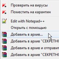 How to put a password on a folder on a Windows computer without and with programs
 Pluton – Free Bootstrap HTML5 One Page Template
 History of ZX Spectrum: Myths and reality New Spectrum
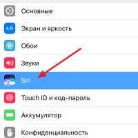 Voice assistant Siri from Apple Siri functions on iPhone 6s
 How to roll back to a previous version of iOS?
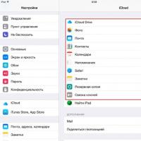 Unlock iPad in four days